
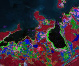
Aquatic & Invasive Species Mapping
Seagrass Mapping
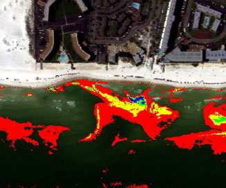
Oil Spill Mapping
The spectral response of vegetative materials is very unique. It varies depending on class/species/variety, environmental conditions, health status, composition, etc. Hyperspectral data of vegetation surfaces can be used for:
-
Small to large scale mapping of vegetation with a GSD ranging from 0.15m to 5m
-
Mapping of terrestrial, aquatic and/or submerged vegetation
-
(Multitemporal) monitoring of crops, target species, target traits
-
Change detection, environmental condition monitoring