
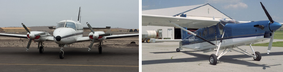
Single, Twin and Multisensor platforms
For large coverage missions, our sensors are flown using a highly reliable base of fixed wing aircraft. Appropriately modified Beechcraft Queen Air, Porter PC-6, Cessna 207 and 208 are all available for sensor missions as requirements and budgets necessitate.
Preferred Air Ops – Low, Slow and Rugged
- STOL Pilatus PC-6
- Ruggedized proven aircraft
- High lift ratio
- Low, slow, safe in mountains
- Wing tanks; seven hours endurance
- Cabin class aircraft
- Multiple sensor ports
LIDAR and Hyperspectral
- Co-mounted LIDAR, hyperspectral sensor and digital imager
- Simultaneous airborne data collection
- Integrated with Leica, Optech and Riegl LIDAR Systems
- Synchronized Navigation Data Stream for Seamless Co-Registration
- Multiple Single and Twin Engine Platforms Available
- Post-mission data fusion and prioritized target map output
- Timeline delivery range from few hours to several weeks for more advanced target classification
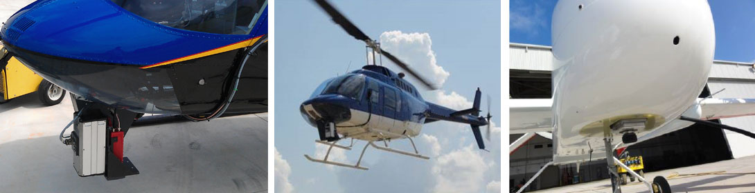
Rotary Platforms
- Ideal for high spatial resolution applications (low and slow)
- Airborne hyperspectral spatial resolution 15cm
- Extensive vendor network facilitates project specific customization and turnkey installation
- Optional co-mounting of hyperspectral with LIDAR , digital imaging systems, thermal cameras and various other sensors
Drone Platforms
- NASA drone platform mission experience with integrated hyperspectral sensor
- Fully autonomous sensor control software developed and written by Galileo; certified by NASA for unmanned real world airspace use
- Key West area sea grass and coral reef mapping; eight hours per day sensor data collection
- Mishap free sensor operations; See press release summary Nov 2012
- Sensor autonomous package flight ready for conversion to other drone platforms
- Efforts underway to seek and utilize commercially viable drone platforms for specialized close range hyperspectral work
See press release summary November 2012: click to download
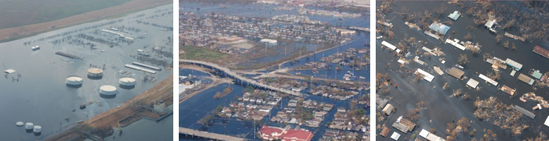
Ancillary Services – Photo Recon & Ground Truthing
Galileo also provides photo reconnaissance services for short notice responses. Galileo assisted FEMA and other customers during the Hurricane Katrina Aftermath to survey residential and industrial areas for damage assessment. All photos and associated geographical information were delivered to the customer in 24 hours.
- Short notice photo recon or specialized tasking
- Turnaround within hours via secure online portal
- Turnkey aircraft operations and management
- Flexible targeting via real-time SATCOM coordination with air and ground teams
- Ground truthing spectral survey options
- Fast response experience:
- Space Shuttle Colombia explosion debris search
- Delta IV rocket mishap debris search
- Hurricanes Frances, Jeanne, Katrina and Rita post-event
- BP Gulf of Mexico oil spill research detection