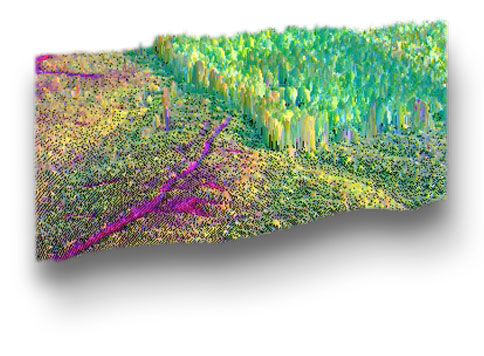
Combining high spatial resolution LIDAR data with the unique capability of hyperspectral imaging improves the data by adding a 3-D perspective.
Galileo is one of a few companies providing highly accurate fused image data products. Hyperspectral data layers can be draped over the LIDAR image, or “fused” Progressive spectral layers show various hyperspectral transformations of surface materials in 3D over large scale coverage areas.
Galileo provides high-resolution terrain data:
-
Point clouds file (ground, canopy and intensity)
-
Contour mapping and topo maps
-
Fusion with digital orthophoto or hyperspectral imagery
-
3D modeling and volumetric calculation